Jet Propulsion Laboratory California Institute of Technology
  • JPL Home
  • Earth
  • Solar System
  • Stars & Galaxies
  • Science & Technology
Bring the Universe to You
Home

PO.DAAC

Follow Us

Navigation

  • Home
  • Dataset Discovery
  • Data Access
    • FTP
    • OPeNDAP
    • THREDDS
    • Web Services
    • SOTO (State of the Ocean)
    • HiTIDE (L2 Subsetting)
    • LAS (L3 Subsetting)
    • PO.DAAC Labs
    • PO.DAAC UAT
      • Metadata Compliance Checker (MCC)
      • PO.DAAC Drive
    • EOSDIS Tools
      • Reverb
      • GCMD
  • Measurements
    • Gravity
      • GRACE
    • Sea Surface Salinity
      • AQUARIUS
      • SMAP
      • SPURS
    • Sea Surface Temperature (SST)
      • AQUA
      • AVHRR-Pathfinder
      • GHRSST
      • MODIS
      • TERRA
    • Ocean Currents & Circulation
    • Ocean Surface Topography
      • JASON 1
      • OSTM - JASON 2
      • JASON 3
      • Seasat
      • TOPEX-POSEIDON
      • GEOS-3
    • Ocean Wind
      • ADEOS-II
      • AQUA
      • CYGNSS
      • ISS-RapidScat
      • MEaSUREs
      • MetOp
      • NSCAT
      • QuikSCAT
      • Seasat
      • SSM/I
    • Sea Ice
      • ADEOS-II
      • NSCAT
      • QuikSCAT
      • Seasat
  • Missions
    • NASA Missions
      • ADEOS-II
      • AQUA
      • AQUARIUS
      • CYGNSS
      • GEOS-3
      • GHRSST
      • GRACE
      • ISS-RapidScat
      • JASON 1
      • JASON 3
      • MEaSUREs
      • MODIS
      • NSCAT
      • OSTM - JASON 2
      • QuikSCAT
      • Seasat
      • SMAP
      • SPURS
      • TERRA
      • TOPEX-POSEIDON
    • Non-NASA Missions
      • AVHRR-Pathfinder
      • MetOp
      • SSM/I
  • Multimedia
    • Ocean Stories
    • Dataset Highlights
    • Animations
    • Images
  • Community
    • Announcements
    • Events
    • System Alerts
    • Spotlight
    • Data Best Practices
    • Education
    • Mailing List
    • User Working Group (UWG)
    • Meetings and Workshops
  • Forum
  • About
    • About Us
    • Acronyms
    • Glossary
    • Data Terminology
    • Data Citation
    • PO.DAAC Metrics
  • Search More

    • Parameter
      • Atmospheric Water Vapor (2)
      • Clouds (1)
      • Geodetics/Gravity (69)
      • Humidity Indices (1)
      • Microwave (1)
      • Ocean Chemistry (1)
      • Ocean Circulation (5)
      • Ocean Heat Budget (1)
      • Ocean Optics (8)
      • Ocean Pressure (32)
      • Ocean Temperature (234)
      • Ocean Waves (19)
      • Ocean Winds (90)
      • Precipitation (4)
      • Radar (48)
      • Salinity/Density (65)
      • Sea Ice (37)
      • Sea Surface Topography (28)
      • Soils (4)
    • Latency
      • Near Real Time (96)
      • Delayed Mode (140)
      • Non-Active (291)
    • Collections
      • ADVANCED SCATTEROMETER (5)
      • AVHRR Pathfinder L3 Daily SST Version 5 and 5.1 (24)
      • Aquarius/SAC-D mission datasets (98)
      • JPL Aquarius-CAP datasets (7)
      • Cross-Calibrated Multi-Platform Ocean Surface Wind Vector Analysis Fields (13)
      • Climate Data Record (17)
      • Group for High Resolution Sea Surface Temperature Datasets (107)
      • Gridded Climate Variables for Model Intercomparison (5)
      • Jason-1 (5)
      • MEaSUREs (30)
      • MODIS Terra and Aqua L3 SST (48)
      • SeaWinds on QuikSCAT Level 3 Sigma-0 Daily Browse Datasets (9)
      • SeaWinds on QuikSCAT Level 3 Sigma-0 Local-Time-of-Day Browse Datasets (4)
      • Quick Scatterometer (9)
      • Rapid Scatterometer (14)
      • Enhanced Resolution Sigma-0 Datasets from BYU/SCP (6)
      • SeaWinds on ADEOS-II Level 3 Sigma-0 Daily Browse Datasets (9)
      • SeaWinds on ADEOS-II Level 3 Sigma-0 Local-Time-of-Day Browse Datasets (4)
      • NASA SMAP Sea Surface Salinity Datasets (3)
      • SPURS-I field Campaign (15)
      • TELLUS (54)
    • Platform
      • ADEOS (9)
      • ADEOS-II (22)
      • AQUA (68)
      • AQUARIUS_SAC-D (78)
      • ARGO (1)
      • Coriolis (11)
      • Cryosat-2 (1)
      • DMSP-F08 (4)
      • DMSP-F10 (6)
      • DMSP-F11 (6)
      • DMSP-F13 (6)
      • DMSP-F14 (6)
      • DMSP-F15 (5)
      • DMSP-F16 (1)
      • DMSP-F17 (5)
      • ENVISAT (19)
      • ERS-1 (6)
      • ERS-2 (6)
      • GCOM-W1 (6)
      • GEOS-3 (1)
      • GFO (2)
      • GOES-11 (6)
      • GOES-12 (5)
      • GOES-13 (10)
      • GOES-15 (4)
      • GPM_Core (1)
      • GRACE (71)
      • GTS (4)
      • Himawari (2)
      • ICOADS (3)
      • ISS (14)
      • InSitu (42)
      • JASON-1 (16)
      • Jason-1 Geodetic (3)
      • Jason-3 (1)
      • MSG (16)
      • MTSAT1R (2)
      • MTSAT2 (3)
      • MetOp-A (28)
      • MetOp-B (9)
      • Meteosat-10 (2)
      • Model (1)
      • NDBC MOORED BUOY (1)
      • NIMBUS-7 (1)
      • NOAA-11 (56)
      • NOAA-14 (60)
      • NOAA-16 (70)
      • NOAA-17 (76)
      • NOAA-18 (83)
      • NOAA-19 (16)
      • NOAA-7 (50)
      • NOAA-9 (56)
      • OSTM/Jason-2 (18)
      • Oceansat-2 (1)
      • Orbview2 (2)
      • QUIKSCAT (34)
      • SARAL (1)
      • SEASAT-A (6)
      • SMAP (3)
      • SPURS1_Drifter (1)
      • SPURS1_Ecomapper (1)
      • SPURS1_Mooring (2)
      • SPURS1_NeutrallyBuoyantFloat (1)
      • SPURS1_Seaglider (1)
      • SPURS1_Seasoar (1)
      • SPURS1_TenuseGlider (1)
      • SPURS1_Vessels (5)
      • SPURS1_Waveglider (1)
      • Suomi NPP (11)
      • TERRA (35)
      • TOPEX/POSEIDON (15)
      • TRMM (22)
    • Sensor
      • AATSR (16)
      • AHI (2)
      • AMI (4)
      • AMR (18)
      • AMSR (2)
      • AMSR-E (33)
      • AMSR2 (6)
      • AQUARIUS_RADIOMETER (48)
      • AQUARIUS_SCATTEROMETER (78)
      • ARGO_CTD (1)
      • ASCAT (5)
      • ATSR-2 (1)
      • AVHRR (6)
      • AVHRR-2 (60)
      • AVHRR-3 (118)
      • AltiKa (1)
      • DORIS (4)
      • DRIFTER_CTD (1)
      • ECOMAPPER_CTD (1)
      • ECOMAPPER_DISSOLVED_OXYGEN (1)
      • ECOMAPPER_FLUOROMETER (1)
      • ECOMAPPER_TURBIDITY (1)
      • ENVISAT RA-2 (3)
      • ERS-1 ALTIMETER (3)
      • ERS-2 Altimeter (3)
      • FLOAT_CTD (1)
      • GEOS-3 ALTIMETER (1)
      • GFO Altimeter (2)
      • GMI (1)
      • GOES I-M IMAGER (3)
      • GOES N-P IMAGER (3)
      • GOES-11 Imager (3)
      • GOES-12 Imager (2)
      • GOES-13 Imager (7)
      • GOES-15 Imager (4)
      • GPSP (1)
      • GRACE ACC (70)
      • GRACE KBR (71)
      • GRACE SCA (70)
      • IASI (2)
      • InSitu (46)
      • JMR (15)
      • LRA (2)
      • MODIS (73)
      • MTSAT 1R Imager (2)
      • MTSAT 2 Imager (3)
      • Model (1)
      • NSCAT (9)
      • OSCAT (1)
      • POSEIDON ALTIMETER (12)
      • POSEIDON-2 (15)
      • POSEIDON-3 (19)
      • RapidScat (14)
      • SASS (6)
      • SEAGLIDER_CTD (1)
      • SEASOAR_CTD (1)
      • SEAWINDS (53)
      • SEVIRI (19)
      • SIRAL (1)
      • SMAP_RADIOMETER (3)
      • SMMR (1)
      • SPURS_ADCP (1)
      • SPURS_CTD (1)
      • SPURS_CTD_MOORING (2)
      • SPURS_METEO (2)
      • SPURS_METEO_MOORING (1)
      • SPURS_TSG (2)
      • SPURS_UCTD (1)
      • SSM/I (11)
      • SSMI (1)
      • SSMIS (5)
      • SeaWiFS (2)
      • TENUSEGLIDER_CTD (1)
      • TMI (22)
      • TOPEX ALTIMETER (9)
      • TOPEX MICROWAVE RADIOMETER (13)
      • TRSR (8)
      • VIIRS (11)
      • WAVEGLIDER_CTD (1)
      • WAVEGLIDER_CURRENTMETER (1)
      • WAVEGLIDER_METEO (1)
      • WindSat (11)
    • Spatial Coverage
      • 38N-38S (1)
      • Alaska (6)
      • Americas (1)
      • Antarctic (2)
      • Antarctica (14)
      • Arctic (17)
      • Atlantic Ocean (17)
      • Atlantic and Pacific (4)
      • Australia (6)
      • Baltic Sea (1)
      • Bering Sea (6)
      • Central America (6)
      • China (6)
      • Eastern Atlantic (2)
      • Eastern Pacific Ocean (6)
      • Europe (6)
      • Global (430)
      • Greenland (6)
      • Indonesia (6)
      • Japan (6)
      • Mediterranean Sea (2)
      • Mid-Atlantic to East Indian Ocean - Baltic Sea to below Africa (1)
      • North Africa (6)
      • North America (6)
      • North Sea (2)
      • North and Central America (1)
      • Northeast Atlantic (3)
      • Oceania (1)
      • Pacific (2)
      • Pacific Ocean (1)
      • Regional (4)
      • SPURS-1 N.Atlantic Salinity maximum region (15)
      • Siberia (6)
      • South Africa (6)
      • South America (6)
      • South Atlantic (1)
      • Southern Asia (6)
      • Tropics (3)
      • Western Pacific Ocean (3)
    To browse for datasets, select a starting category from the left
  • Access
  • Visualize
  • Help
  • Protocols

    ftpx_icon_portal.png


    PO.DAAC's data products are accessible via our anonymous FTP server, ftp://podaac-ftp.jpl.nasa.gov

    http://opendap.jpl.nasa.gov/opendap/


    OPeNDAP handles transport, translation and subsetting of data residing in most Earth science data formats.

    threddsx_icon.png

    The THREDDS Data Server is a web server that provides metadata and data access for scientific datasets, using a variety of remote data access protocols.

    Webservices image PO.DAAC Web Services are APIs that can be accessed through standard web protocols. They use a ReST model with calls issued over a HTTP connection.  On receipt of a request message, our services return the response in either an XML structure or, optionally, a JSON format.


  • Subsetting

    /hitidex_icon_portal.png


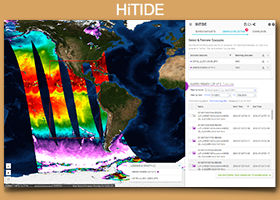
    The High-level Tool for Interactive Data Extraction (HiTIDE) is a web-based interface facilitating the search, imaging, and extraction of select Level 2 "swath" datasets from PO.DAAC's archive. 

    lasx_icon_portal.png

    The Live Access Server (LAS) enables the web user to: visualize data withon-the-fly graphics; request custom subsets of variables in a choice of file formats; access background reference material about the data (metadata); compare (difference) variables from distributed locations.


  • PO.DAAC Labs
    Webification image Webification (W10n) is ReSTful Webservice technology providing simplified access to PODAAC data and metadata via HTTP/HTTPS protocols with URLs comprised of well-defined parameters. >>
    datacastingx_icon.png

    Datacasting is an RSS-based technology for accessing Earth Science information. With Datacasting, data providers can reach untold numbers of users using standards compliant PO.DAAC Datacasting Feeds technology. >>

    coastalmarinex_icon.png

    The NASA's Coastal Marine Discovery Service leverages open source technology for unifying coastal ocean data search and discovery with further extension of data visualization, interrogation and query using the web-based Environmental Analysis System (EASy) GIS framework. >>


  • PO.DAAC UAT

    SOTO

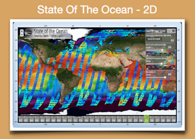
    State of the Ocean (SOTO) Beta Version 4.0 is an interactive, web-based tool to generate informative maps, animations, and plots that communicate and promote the discovery and analysis of the State Of The Ocean (SOTO).  It provides a mirror to reflect what the data is capturing, and present what the data is telling us, helping to uncover valuable information that is otherwise not obvious or easy to grasp. 

    PODAAC_MCC

    The Metadata Compliance Checker (MCC) is an online tool and web service designed to check and validate the contents of netCDF and HDF granules for the Climate and Forecast (CF) and Attribute Convention for Dataset Discovery (ACDD) metadata conventions.  It produces quantitative scoring for these convention attributes as HTML, PDF or JSON outputs.

    PODAAC_Drive

    PO.DAAC Drive is a new way of browsing data at PO.DAAC. Drive is an FTP alternative that allows users to access data via browser and command line as has been traditionally done, but can also allow users to mount the remote data to your own computer, seeing the data as if you had the entire PO.DAAC archive mounted on your own machine!


  • EOSDIS Tools

    reverbx_icon.png

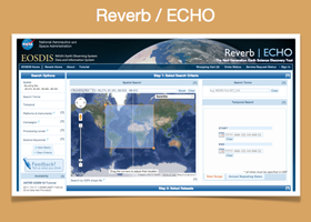
    NASA's next generation metadata and service discovery tool, which provides search and access capabilities for dataset holdings at all of the Distributed Active Archive Centers (DAACs) as well as the PO.DAAC.

    gcmdx_icon.png

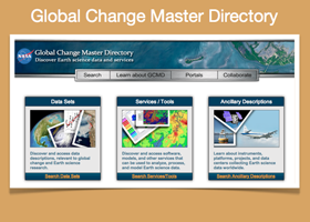
    The GCMD holds Earth science data set and service descriptions, such as location of the data or service, associated investigators and other contacts, spatial and temporal coverage, and resolution that provide vital information to help determine whether the data or service meets the user’s needs.


  • SOTO (State of the Ocean)
    soto2dx_icon.png

    SOTO 2D provides near real-time data layers (vector and image) that are visualized in an HTML5 interface utilizing open-source tools. SOTO 2D data layers are annotated to give contextual descriptions of the ocean's features and events, and kml overlays (ice extent, hurricane tracks, clouds).


  • Aquarius L3 Image Browser

    aquariusbrowserx_icon


    Images are produced from the validated Version 2.0 Aquarius/SAC-D data.


  • Ask PO.DAAC

    podaac_logoQuestions? Answers.

          Visit our:  PO.DAAC Forum


          Follow Us:                                         

    FACEBOOK  

    YOUTUBE 

    TWITTER

  • Dataset Search Help

    podaac_logo Need help in searching for a dataset?

    The keyword search capability on the PO.DAAC Web Portal supports a ”Google-like" query syntax  NOTE:  that keyword search is NOT case sensitive; a search for "sea surface temperature" will return the same results as a search for "Sea Surface Temperature".   More >>


    Include a white space between the words to search for pages that may have just one of several words,

    Example: Search for   GHRSST  L4   will return datasets that have keywords GHRSST or L4

    Wildcard (*) will search for partial text so you do not have to type the full word.

    Example: Search for GHRS* will return datasets that have keywords GHRSST

    Add a plus (+) before a word to include all results that include that word.

    Example: Search for    +GHRSST +L4    will return datasets that have keywords GHRSST and L4

    Add a dash (-) before a word to exclude all results that include that word.

    Example: Search for    GHRSST  -L4    will return datasets that have keywords GHRSST but not L4
     

    Use quotes to search for an exact word or set of words.

    Example:  Search for    "sea surface temperature"     will return datasets that have keyword phrase "sea surface temperature"

    Plural matching

    Example: Search for   temperatures   will return datasets that have keywords temperature or temperatures

    You can combine any of the above query syntax.

    Example: Search for +GHRSST +GOES* will return datasets that have keywords GHRSST and any of the GOES missions (GOES-11, 12, 13, 15).
  • Data Citation

    podaac_logoData Citations and Acknowledgments.

    NASA data are freely accessible; however, when you publish these data or works based on the data, we request that you cite the datasets within the text of the publication and include a reference to them in your reference list.

    A recommended citation is provided for each dataset and appears on the PO.DAAC webpage that describes the dataset. The elements contained in the recommended citation can be reorganized for compliance with a particular reference style that is specified by a publisher.

    For more details go to Data Citations and Acknowledgements page.

  • First Light Science Data from the CYGNSS Mission

    NASA’s Cyclone Global Navigation Satellite System (CYGNSS) constellation of eight spacecraft made its “first light” measurements of the ocean surface on Jan. 4, 2017.

    Date:
  • Successful Launch of New NASA Hurricane Tracking Mission

    The Cyclone Global Navigation Satellite System (CYGNSS) launched on December 15. CYGNSS will provide scientists with advanced technology to see inside tropical storms and hurricanes as never before.

    Date:
  • 2016 FALL AGU Meeting

    Several PO.DAAC Data Engineers and Scientists presenting at the 2016 Fall AGU Meeting, the largest Earth and space science meeting in the world.

    PO.DAAC represents at the 2016 Fall AGU Meeting in San Francisco, California.
    Date:
  • New PO.DAAC Ocean Story, "Record Texas Flooding Left a “Horseshoe” in the Gulf of Mexico"

    SMAP SSS revealed a unique "horseshoe" pattern in the Gulf of Mexico in 2015. This signature was the result of a freshwater plume from the Texas flood, Mississippi River plume, and an unusually strong Loop Current and its anticyclonic eddy.

    Date:
  • Sad Day for Ocean Surface Winds

    NASA's ISS-RapidScat mission ends after a successful two-year mission aboard the space station.

    Date:

Announcements

MODIS L2P errors
Thursday, January 19, 2017
Level 4 CMC 0.2deg SST Dataset Production Stops Soon
Thursday, January 19, 2017
New State of the Ocean (SOTO) beta version available on the PO.DAAC User Acceptance Tools (UAT) Server
Wednesday, January 11, 2017
More »

Events

97th Annual AMS Meeting
2017-01-22 | Seattle, WA,
Aquarius CalVal team meeting
2017-01-10 | Santa Rosa, CA
Fall AGU 2016
2016-12-12 | San Francisco, CA
More »

System Alerts

PO.DAAC UAT, PO.DAAC Drive and MCC Tools will be temporarily unavailable due to maintenance on 1/5/2017.
Thu, 01/05/2017 -
11:30 to 12:30
PO.DAAC Dataset Discovery will be temporarily unavailable due to maintenance on 12/10/2016.
Sat, 12/10/2016 -
00:30 to 05:30
More »

Spotlight

2016 Fall AGU Meeting
PO.DAAC represents at the 2016 Fall AGU Meeting in San Francisco, California.
More »
  • Ocean Stories
  • Dataset Highlights
  • Animations
  • Images
Record Texas Flooding Left a “Horseshoe” in the Gu...
Tue, 12/06/2016
SMAP SSS revealed a unique "horseshoe" pattern in the Gulf of Mexico in 2015. This signature was caused by the freshwater plume from...
Figure 2. Location of the SPURS-2 study area within the eastern tropical Pacific the low-salinity, high precipitation region influenced by the ITCZ.
From Dry to Wet, Salty to Fresh: SPURS2 embarks on...
Tue, 08/30/2016
On August 19, 2016,  the R/V Revelle began survey operations that will run through the middle of September 2016 at the site of the ...
More Ocean Stories »
Example of a spherical cap Mascon solution for 1 arbitrary month
JPL GRACE Mascon Ocean, Ice, and Hydrology Equival...
November 17, 2015
The JPL GRACE Mascon Ocean, Ice, and Hydrology Equivalent Water Height (hereafter, Mascon) products are now available as part of the...
Figure 1.  SSHA from January 3, 1950
Reconstructed Sea Level Dataset
June 17, 2013
The Reconstructed Sea Level dataset contains sea level anomalies derived from satellite altimetry and tide gauges.  Since 1993,...
More Dataset Highlights »
Embedded thumbnail for Rising seas, by decade
Rising seas, by decade
Monday, December 5, 2016
For over 20 years, satellite altimeters have measured the sea surface height of our ever-changing oceans. This series of images shows...
Embedded thumbnail for 22-year sea level rise - TOPEX/JASON
22-year sea level rise - TOPEX/JASON
Monday, December 5, 2016
This visualization shows total sea level change between 1992 and 2014, based on data collected from the TOPEX/Poseidon, Jason-1 and...
More Animations »
Jason-3 Sea Level Anomalies
Jason-3 begins mapping the ocean
Fri, 03/25/2016
Launched on January 17, 2016, Jason-3 is a partnership that includes NOAA, NASA, CNES and EUMETSAT. After launch, Jason-3 was...
Tehuantepecers and their associated Oceanic Biophy...
Sat, 11/12/2011
Tehuantepecers or Tehuanos are accelerated winds (i.e., gap winds or gap jets) that develop downstream of the Chivela Pass in Central...
More Images »

Image of the Day

SSHA 10 Days
Sea Surface Height Anomaly: SARAL, Jason-2 and Jason-3 Measurements from 10-Jan-2017 to 20-Jan-2017

State Of the Ocean (SOTO)

New 2D web-map version of State of the Ocean (SOTO).
  • RSS Feed
  • Privacy
  • Data Citation
  • Glossary
  • About PO.DAAC
  • Contact

PO.DAAC Mailing List

Upon successful submission, you will receive a confirmation e-mail in your inbox.

Image CAPTCHA
Enter the characters shown in the image.
Get PO.DAAC Updates by Email Subscribe »
Clearance Number: CL05-0770